
.svg)
Airfield inspections with Augmented Reality


Problem
Airfield inspections suffer from a decentralized paper-based workflow that allows for multiple points of failure and inefficiencies. We interviewed airfield maintenance professionals at three airports and one Air Force base and identified the following common issues:
- Manual reporting of inspection results
- Conveying the exact location of the defects
- Tracking the status of the work orders
They reported that 1 out 3 hours of each repair is wasted on finding and mapping the location of damage and 15%-20% of total time of OSS(Operational Support Squadron) crew is spent on processing paper records. Leadership is often lacking data to make the following typical decision:
Should I apply a quick fix and potentially face a bigger issue in the future, or should I repair it now but shut down the airfield?
Solution
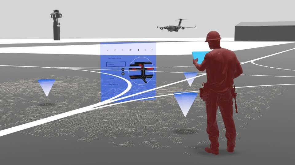
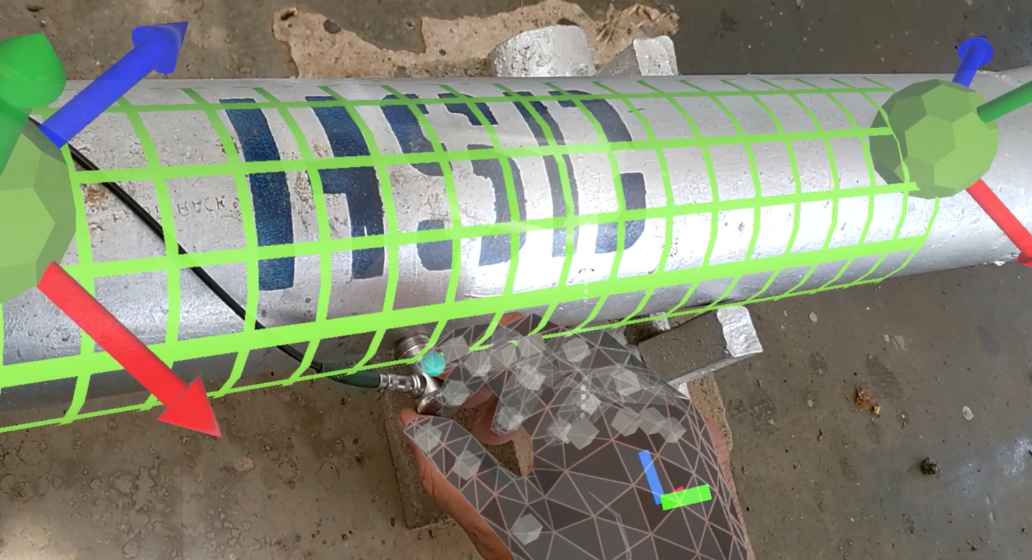
Using augmented reality, inspectors are able to report damage digitally and capture the accurate location by attaching coordinates (Lat/Long) to a discrepancy record. This greatly increases the situational awareness of all parties (civil engineering, environmental, safety, etc.)involved in the workflow. In addition, they could attach pictures to the report thus supporting decision-making and helping to inform subsequent corrective actions.

Civil Engineers and other airfield staff will be able to find the exact damage location instantaneously. Accurate visualization of the Temporary Construction Waivers (TCW) will speed up the evaluation for commanders. With the real-time digital quality records, management will have more transparent and trustworthy data for planning the repairs. This saves crucial time and money, along with, most importantly, increasing the readiness of an airfield.

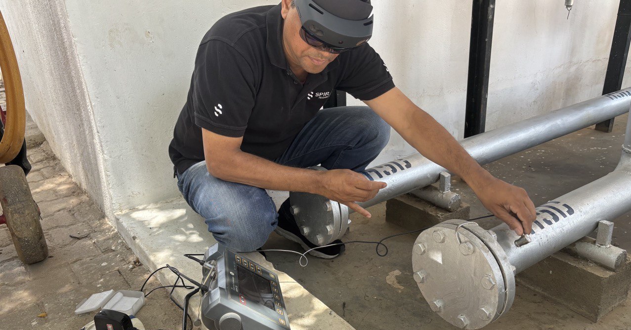
To enable faster inspection workflow, Spiral puts checklists and forms into an easy-to-use tablet interface to speed up routine reporting, eliminating the need for paper forms. All data is accumulated on a Digital Twin that includes historical inspection data (e.g. Pavement Condition Index, PCI),3D CAD model, real-time operational data, maintenance metadata, imaginary surfaces, elevation, etc.
With access to the Digital Twin through the tablet or an AR headset, operators are able to perform visually and algorithmically accurate obstruction analysis, leveraging sophisticated data tracking the condition of pavement, lighting, navigational aids, and barriers.


.png)
.png)
.png)
.png)
.png)
.png)